Forum Replies Created
-
AuthorReplies
-
Former Member
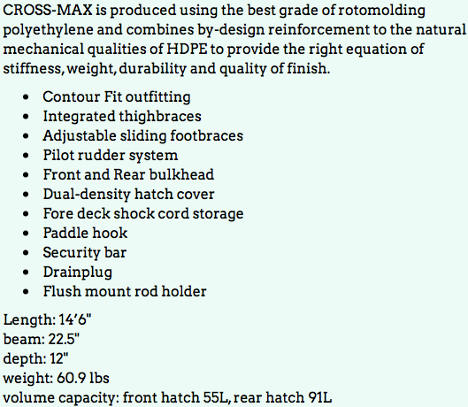
Kayak recently purchase but need to upgrade. would let go for 900$
also:
50 l dry bag MEC -50$
MEC first aid kit 10$
Brooks neoprene skirt 90$
2 paddle float 10$ each
pellican Mini D case – 30$
2 mec dry bag 10$
 Former Member
Thanks for the replies! I camped there Friday night and there were kayaks everwhere: in the water, up the ramp in the woods, on the dock, basically wherever they would fit. Since everyone was taking the risk of leaving their kayaks unlocked and unattended, it gave me a great false sense of security (haha!), I slept like a baby, and paddled out the next day. I did keep my paddles and other pricier items at my campsite though.
July 14, 2019 at 7:18 pm in reply to: Whytecliff Park to Keats Island overnight Trip – July 20th #17430Maureen BenzonHi Anna,
It is a 14nm paddle. We are camping so will need time to pack up in the morning, but will leave as soon as we are ready. We should be back late afternoon, but as the group is unknown, it is very hard to estimate.
It will be lovely to see you again if you decide to come’
🙂
Maureen
July 14, 2019 at 9:35 am in reply to: Whytecliff Park to Keats Island overnight Trip – July 20th #17429Former MemberWhat time do you think you’ll be back on Sunday?
July 13, 2019 at 8:34 pm in reply to: Short Notice Paddles. Personal trips not officially sponsored by SKABC #17428Former MemberSunday July 14 – Short day paddle (about 10 km total) on the Alouette River starting at Harris Road in Maple Ridge. Meet at 10:45 am bring a lunch. The difficulty level is 1 as there is minimal current in this part. Please phone me if you are interested. Shelley Lear 604-437-1549 (landline, no texts)
July 13, 2019 at 1:48 pm in reply to: Whytecliff Park to Keats Island overnight Trip – July 20th #17427Vincent LawIf anyone is interested in car pooling pls contact me. I’ll be starting from Kits area and can take one more kayak and paddler.
Former MemberEvery single year, for the last 3yrs- we usually just left our kayaks on the dock without locking or bringing it to the top leading (by the washroom) as i can’t carry it due to shoulder issues. But this past June, someone move our kayaks to the top landing in the middle of the night. It was early morning when I found out and it was not the greatest feeling (I mean, nothing compared if it was stolen). Lesson- lock your kayak! But be weary that during peak time- it can get really busy and get packed with group campers due to proximity to deep cove so if you can carry it to the top landing- pls do so to reserve spots for those who can’t. Happy kayaking!
Quirine SchuyffWhen we brought our kayaks there we brought them up onto the slope right by the dock. There wasn’t much room on the dock as people were sitting everywhere.
Heather HarbordI gather these Twin Islands are the ones near Belcarra. However, there is another set of Twin Islands off the coast of Cortes Island in the northern part of the Strait of Georgia. They are where the Queen used to stay when she took a day off on her tours of BC. However, her German cousin who owned them, sold them to Mark Torrance from Seattle. He does NOT want people camping on the islands and has remote cameras hidden all over the islands so that the caretaker can keep an eye on what is happening. They make a nice day paddle from the Copeland Islands just north of Lund. Sometimes groups can stay at the big lodge for a price. I once stayed there as part of a Misty Isles Adventures trip so I know it is well set up and pricey. Torrance has his own power system run from solar panels and also his own internet which he sells to people on Savary and Cortes. It’s called twincom.
Maureen Benzonbtw. Kayaks DO get stolen in Vancouver. Mostly from cars tops (even if locked on) and one club members lost 2 from her town house complex, so don’t get too complacent. However, I do leave mine unattended on the beach at Deep Cove and other venues, but I make sure to take my expensive paddles and electronics with me…
I think you will be quite safe at twin islands. I have seen people leave kayaks tied to the dock, or pull them up onto the dock, but never carry them up to the camp sites. Be careful where you leave it. Someone put their kayak on the dock under the walkway, and when they got up in the morning the rising tide had caused it to be completely crushed.
Former MemberStephen, if a Canadian did steal the boat, they would likely leave a note of apology. 8-). We haven’t met yet but you already made me laugh and simultaneously established a small amount of skepticism about your character. Haha!
Former MemberHi Phil,
Oh don’t worry, Canadians would never steal your boat. By the way, what date were you planning to leave your kayak tied up to the dock overnight at Twin Islands? 😉
Former MemberHas anyone camped at Twin Islands and *not* hauled their kayak up into the main camp area, instead leaving it tied up at the dock? That curved, narrow ramp up from the dock is not friendly for getting a tandem up the hill if you’ve got an old shoulder injury and don’t want to lift your kayak up above the ramp railings to get it around the corner 8-).
Anyone have issues with kayak theft? Do I sound like someone from NYC asking if my kayak is going to get stolen, or does that happen around here?
Former MemberI want to thank everyone for all of the informative replies. Lots to learn which is both exciting and humbling!
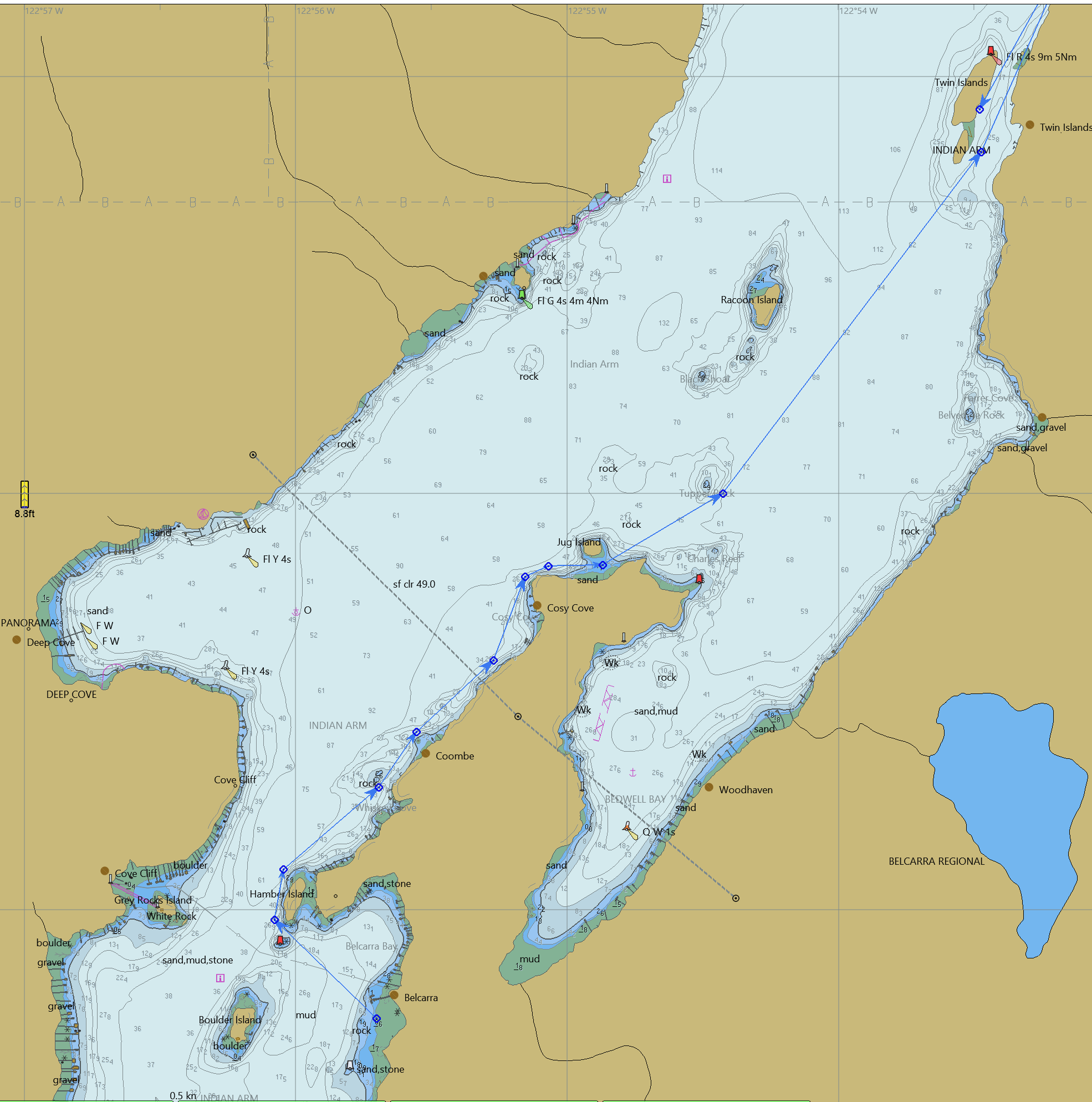
I bought CHS Chart 1 and a chart for Indian Arm, starting my paper chart journey. Then, based on some info from Nick I also looked into OpenCPD, went down that rabbit hole, and found this comment on OpenCPD: “Note: O-Charts carries affordable official licensed Canadian charts now”. Further down that rabbit hole, and Euro 20 later, I had a full set of charts for the West coast of Canada installed in OpenCPD. They don’t meet “carriage requirements” but seem pretty good for exploring/planning/etc. Just wanted to share in case this is news for any of you. If anyone wants to learn more about this, let me know. Here’s a PNG from a screen grab.
 July 10, 2019 at 7:22 pm in reply to: Short Notice Paddles. Personal trips not officially sponsored by SKABC #17417Quirine Schuyff
Destination from Jericho will be determined by weather, water and group dynamics. I am open to relative beginners but you MUST:
-Be able to handle a kayak in turns and moving forward and be able to do a wet exit.
-Have all required safety gear and an appropriate style kayak. (or canoe)
-Come dressed appropriately for weather AND water. Depending on weather I may wear my drysuit. If you do not have one then you must carry a full change of warm clothes in a dry bag which will be accessible on the water. For wearing on the water:
A thin synthetic or fleece layer(s) on the bottom and synthetic layers on top with a wind breaking jacket. Water worthy shoes. A sunhat. Gloves. Sunglasses. (we may travel directly INTO the sun) .
Other suggested items: A headlamp and/or other light source. A snack. Water. Camera. Chocolate for the organizer.
Return time will depend on group but I will aim for 8:30 latest return time. Please allow some leeway for unexpected circumstances.
Please email me with details: quisch@gmail.com
NAME
EMAIL
PHONE
SKILL LEVEL
BOAT: MAKE,SIZE,COLOUR
EMERGENCY CONTACT: NAME/PHONE
CAR: MAKE, MODEL, COLOUR, LICENSE -
AuthorReplies