Forum Replies Created
-
AuthorReplies
-
Former Member
See the ad and picture here:
https://vancouver.craigslist.org/van/spo/d/vancouver-kayak-17-rotomolded/6943813258.html
Heather HarbordThis is apparently the second year in the Dept. of Forests’ new policy for Recreation Sites. They have put contract hosts at several in the Powell River area and are charging $15/night. Triton, who wears a green host vest and drives around in a black truck with “HOST” in the windshield, is in charge of Shingle Beach. He says PLEASE check with him before parking and if you can’t reach him, park up above the beach, not on it.
Have a look at his website: https://www.shinglebeachcamping.com/ If you have questions, send him an email at: reservations@shinglebeachcamping.com
NB Use this website rather than going through BC Recreation Sites websites which may give conflicting information.
If you are using Shingle Beach as your launch point we ask that you park in designated paring areas and leave basic information on a card, visible on your dash, including name and number of people in your party, your destination, when you expect to be back and a cell number to reach you as well as an emergency contact number. He charges $5 a day for parking.
Kevin AmosYour old phone is essentially the same as a tablet. You can do anything except make calls over wifi. When you are not on wifi you can use it like in airplane mode. Here are some apps you might find useful.
– Maps.me for gps is very good but a bit quirky to get use too.
– Pocket for saving webpages for offline. Ie tide tables
– A PDF reader you may have a preference already.
– A Notes App. I like OneNote. I use this for packing & camp recipes
– Google Play Music for storing your old music
– TripIT for trip planning. I use this for my kayak trips planning.
– Google Hangouts to make calls over wifi to landlines.
– Your camera will still work to take photos.Have fun and it will be interesting to see what people are using.
Former MemberHi Allan,
So, the technical details so far:
-The old handset is a Galaxy S5 Active, which is a “ruggedized” “sport” model that is pretty tough (I’ve dropped it many times, has chunks out of the built-in armour, but never cracked the screen or broke open).
– It also supposedly has pretty good waterproofing, though I have never really tested it.
-I have downloaded a free Android app called “Polaris GPS Navigation”. It lets me download maps (street, topos, marine…) that live in the phone and can be used offline. **does anyone have any experience with this app? Or suggestions for other GPS apps?**
-The plan is to use it without a data plan or sim card. I can do all my app and map downloading over my house wireless. The GPS function of the phone appears to work fine without a data plan. I have read that it may even be usable as an “emergency” phone—apparently cell providers have to let you dial 9-1-1 over any network in range, even if you are not subscribed or have a sim card. **can anyone verify if this “emergency” use is true?**
–I have ordered a bright armoured case designed for this model, and a waterproof floating phone bag with a lanyard ($20 for both on Amazon…) The idea is to set up the GPS tracker app, put it in the bag, attach the thing to my PFD. Then I can refer to the map, note my speed, location, heading, etc as I paddle, and later download the logs of my track on the water.
–There are “extended batteries” setups available for many phones that come with a replacement back for the phone, that adds ½” or so to the phone thickness, and a bigger-than-original replacement battery. Still looking for the one for my S5 “active” model. Between a bigger battery and some “power saving” settings in the phone, I hope to get a long battery life.
Steve
Former MemberIt’s a cool idea Stephen. Better to upcycle technology than toss it where possible. Off the top of my head:
Pros
– Cases and accessories can be got for cheap, depending on how popular that particular handset was. You’ll want to hurry though.
– Cheaper than buying a new GPS outright.
– Larger screen and touch capacity.
– More apps available.
– Cellular voice and data capable if you choose to go with a pay as you go plan and are in range.
Cons
– Much less rugged than a dedicated GPS unit.
– Battery capacity and power management options are much more hands on and depend on the OS.
– GPS antenna probably less sensitive.
– Application options depend greatly on handset OS: iOS vs Android. I think there’s more options in Google Play.
– Data storage capacity depends on handset: you’re better off with Android handset that supports Micro-SD expansion for additional map data.
I’m a tech guy so this seems like a fun project. If you’re not a tech person, you may (understandably) lose patience with the process.
Former MemberSo, I just upgraded my phone, and the thought occurred to me that I might be able to re-purpose the old one (it’s old and not worth much to sell, but works fine) as a kayak GPS and emergency phone.
Has anyone done this or have any thoughts or advice?
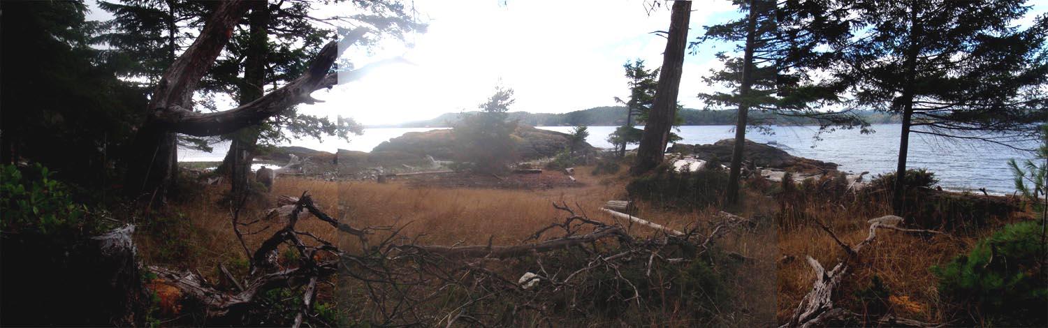
Mick AllenAnd then looking from Partington Pt S over to Jedediah, you can get an idea of the usability of the site as well as a basic indication of the proximity of Jedediah. [to get a better view of any image, rt click and ‘view image’]
 Mick Allen
The site identified as Partington Pt South on the bc marine trails map and it’s close neighbour Mt Shepherd [I called Partington Pt North – which sorta makes sense to me as they are so close] are 2 great staging areas in that part of Texada island. The beach on the north site is a little smaller and there is a bit of a grass hill to hike up but there are loads of flat regions there. The South side has a beach to die for and an immediate flat upland that could hold many tents, though not sanctioned by BC parks. But in a pinch if one had to mark time for weather, sure looks great.
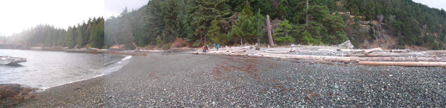
The far left beach in the distance is the northern site.
Heather HarbordI live in Powell River and wrote an out of print sea kayak guide book to the area. On Tues, I’m driving to the Shingle Beach campsite (google it for directions) to car camp Tues and Wed night. I’m driving a blue Subaru Outback Licence 575-KPG and not taking a boat. Many people leave their vehicles at Shingle Beach parked just up from the beach while they cross to Jedediah. You might want to check in with the on-site caretaker. Camping fees are $15/night. I don’t know if there is a cost for parking but I’ll inquire and report back on this forum.
Make sure you have a VHF or weather radio for weather forecasts. Watch out for Qualicum winds which are strong in Sabine Channel. I have found it best to cross either early in the morning or in the evening when, most of the time, the winds are down. There’s nowhere to land at Partington Point (4 nautical miles south of Shingle Beach) and the Cook Bay cottagers have a reputation for being hostile. Further south there is a good camp spot on a little peninsula (before Napier Creek.) Bring water or get it at Napier Creek.
The crossing to Jedediah from Partington Point is 1.1 nautical miles. In the evening watch for cruise ships which come up on you very quickly and leave a huge wash.
Boom Bay dries to sticky mud so I wouldn’t camp there. We arrived at high tide which was fine but had to leave on low tide which was not. Instead, continue round the western coast of Jedediah, pass the entrance to Long Bay and camp in one of the next two small inlets. I can’t remember which is the best one but it has a steeply sloping rocky beach at low tide so no mud and minimal hauling of gear. Lots of grassy tent space. Trails will lead you over to Long Bay (5 mins)and Home Bay (20 mins approx.) where the rest of the mob are camping and anchoring.
Mick AllenSabine channel does get some wind and currents to 2 knots – so if you’re concerned, time your crossing and check the weather.
Otherwise it’s just 1 1/2 kilometers directly across and there are places to be in some shelter as you make up your mind in doing that crossing. Partington Point north and especially South on Texada Is are great places to mark some time if you have to while deciding what the heck to do.Helen RobertsHas anyone paddled from Texada (or the Sunshine Coast) to Jedediah? Any advice?
Former MemberI would be interested to come and see tomorrow 604-369-5171
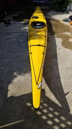
Former MemberNecky Elaho Kayak for sale. Fibreglass sea kayak. 16 feet long. Excellent condition. Have taken it on a few multi-day tours off the coast of Vancouver Island and it has been a treat to paddle. Has a hard chine so is fun in the waves too!
Contact Shelley through Craigslist https://vancouver.craigslist.org/van/boa/d/vancouver-necky-kayak/6937968166.html
or reply to this ad.
 Former Member
Hi Daniel, I am interested in the MEC first aid kit. You can call or text me at 604-230-0311
mary yee
Former MemberHi,
I am interested in the spray skirt – and maybe a few of the dry bags.
Pamela 604-362-7339
-
AuthorReplies