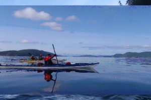
There are many good reasons to paddle in Desolation Sound – warm water, close to Vancouver, sunny weather, spectacular scenery……… However, for all those reasons the area can be very busy with kayakers and boaters. If solitude when kayaking is a priority, then Desolation may not be for you. The only way to beat the crowds is to paddle in the off season. Our group: Graham Lorimer, Maureen Benzon, Christine Joffres, Rita Buchwitz and myself caught the 7:30 ferry from Horseshoe Bay May 14, 2012. The plan was to kayak before the May long weekend, before the busy summer season started. It worked – in seven days of paddling we only saw two couples and one school group!
Monday May 14 – We launched at Lund @ 4:30 PM. A two hour paddle in the sun with a 10 km wind in our faces found us at the most northerly campsite in the Copeland Islands. We were the only ones there to enjoy a great view. The forecast for the next 5 days – sunny/windy with no rain!
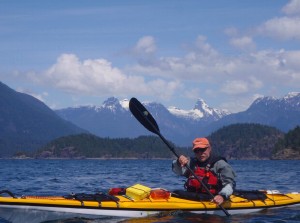
Tuesday May 15 – On the water at 8:30. My number one goal on this trip was to see the huge Coast Mountains east of Desolation. Rounding Sarah Pt. we got our first look at those massive pyramid shaped peaks covered in snow! We pulled into Feather Cove to stretch our legs. This is the start of the Sunshine Coast Trail and is a possible camp spot if the tide is not too high. We crossed to Zephine Head and then to Mink Is. in light N.W. wind. Arriving at South Curme Island we checked out the campsite. Beautiful views, many small tent sites, but a difficult area to get kayaks up out of the water. Not a good group spot but lots of privacy for individual tents. Next stop North Curme. It is a 5 star campsite! Many tent spots including “the penthouse”, an elevated, flat, rocky area with lots of room for a group our size or larger. The N.W. wind picked up in the afternoon, but we were warm in the lee side. Desolation has some of the warmest water on the coast, so we all went swimming! Not too many kayak trips in May can you swim in the ocean.
Wed May 16 – We were not planning on putting many miles on this trip, just enjoying the area. So, we were on the water at 9:00 to do some island hopping: Otter, Melville and Scoball Islands, then to Laura Cove and Prideaux Haven. The water was clear with all kinds of sea life visible, especially at low tide. We checked out other campsites on Melville and Otter Islands for the Marine Trails Network. There were great views from both sites and they had protected launch areas from the wind in two directions. We knew that the High Pressure system would produce N.W. wind in the afternoon and paddled into a stiff headwind back to camp. The night sky was going to be moonless for the week of our trip, and the sky after midnight was black with brilliant stars every night.
Thurs May 17 – With the forecast for high winds in the afternoon for the next two days we decided to stay at our great campsite and do more day trips.  The destination for the day was Tenedos Bay by way of Otter Is. and Bold Head. There was spectacular paddling under the vertical cliffs of Bold Head. In the last Ice Age lava flows hitting a glacier produced those 300-400 ft. sheer cliff walls. Unwin Lake flows out to Tenedos Bay. A 10 minute walk takes us to the lake where Rita swam. Swimming turns out to be a daily ritual for Rita. We may have spent too much time at the lake as we encounter a stiff wind leaving Tenedos Bay at noon. When we rounded Bold Head a very strong wind hit us head on. With 2-3 ft swells and some whitecaps, we paddled hard for an hour in a tight “chevron formation” to Riley Rock where we rested in the lee. We now had some protection from Mink Island and the crossing got easier. Curme Is. campsite is in the lee of N.W. wind and we returned to a warm afternoon in camp.
Friday May 18 - I got up at 2 AM to look at the stars. A brilliant, dark, panoramic sky gave me views of the Milky Way and more constellations that I could name! The ravens have been my alarm clock and at 5:15 their screeching woke me to another windless morning with the water like glass.  We break camp with the plan to Coast Range. At least 6 of the peaks looked like the Matterhorn or volcanoes. That one hour paddle was one of the trip hi-lites for me. From the head of Roscoe Bay it was a 15 minute walk to Black Lake. Swimming and eating lunch was peaceful and relaxing until the N.W. wind picked up. We figured, if the wind was strong at the lake, it may be stronger in Homfray channel, and that proved true. Coming out of Roscoe Bay and around Marylebone Pt. we were hit with a very strong wind on directly on our bow. Rather than a hard six mile paddle to a campsite that we didn’t know at Martin Is., we agreed to go back to our “home, sweet, home” at the Curme Is. We paddled hard for an hour and 15 minutes with Graham’s GPS showing our speed of only 2.2. km/hr. One nice feature of a GPS is knowing your “time made good” when you are in current and/or wind. We landed at our old campsite with luck on our side. Ten minutes later a group of 18 high school kids, teachers and guides arrived looking for a site. With a sigh of relief from us, they continued on to S. Curme. If you like oysters, the Desolation area is heaven. Christine “the oyster lady” cooked them every day for her and Rita’s supper.
Saturday May 19 – Everyone was on the same routine by day 6. Breakfast finished and we were on the water by 8 AM. The paddle for the day was 12 miles to Refuge Cove on W. Redonda Is. and back. Another cloudless sky and mirror-like water.  We stopped to check out the campsite on Martin busy place, but on May 19 it seemed like a Ghost Town. We were looking forward to a coffee and fresh baking, but nothing opens until the May long weekend. The weather pattern for us that week seemed to be dead calm in the morning with the N.W. wind picking up by noon. On the way back to Curme Is., we took advantage of that N.W. wind behind us on the crossing to the inside of Mink Is and even caught a few small waves to surf on!
Sunday May 20 – Our plan was to head home Sunday instead of the busy Monday of a long weekend. The first stormy weather of the trip was predicted mid day, so we had a quick breakfast of coffee and bannock and were on the water at 7 AM! It was overcast, with no wind, the water was calm. All this made for an eerie silence. So quiet you could almost hear a pin drop with the occasional bird sound in the distance. With a relaxing paddle stroke we were making 3.2 – 3.6 knots all the way to Zephine Head. Rain started then and we picked up an ebb current coming out from Okeover Inlet pushing us north of Sarah Point. We tucked in tight close to Feather Cove and rounded Sarah Point where we picked up the ebb current for the next 2 km. At 10 AM we were at the north end of the Copelands and started to hear the first sounds of life – boats, houses on shore, helicopters. We were back from our 6 days of quiet paradise and into the busy world. We landed in Lund 3 hours and 50 minutes from leaving Curme Is! After loading the kayaks on the vehicles we went to Nancy’s Bakery. This is the rainbow at the end of a kayak trip – great coffee, baking, sandwiches, soup ……
Thoughts on kayaking in Desolation:
Great scenery – mountains, especially in the spring covered in snow.
Weather – dry area of the coast. We were especially lucky and had 6 days and nights with no rain.
Warm water – even in May were swimming in the ocean!
You are always dealing with wind and current.
Good communications – cell coverage & lots of boats for VHF use.
Limited number of campsites – if you have to go in the summer, a base camp with day trips may be best.

