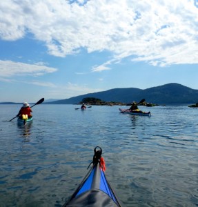
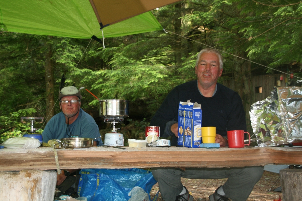
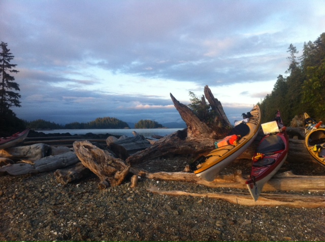
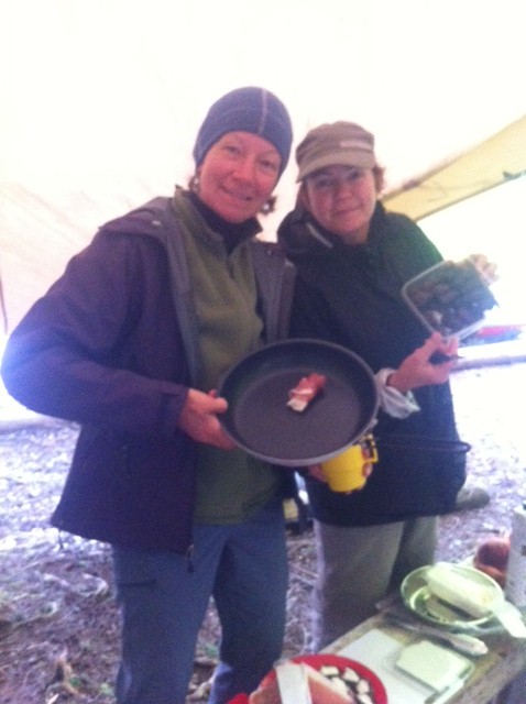
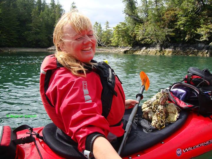
More pics from an enthusiastic kayak group! Broken Group June 16-22, 2013

Linda's inspiring photos....paddling, cooking and hiking the Broken Group!

186 sized213 sized145 sized

Monique's Sunset....Sous Chefs....and the very symbolic L&R Summer Solstice poem! photophoto.JPG3photo.JPG fire

Pics and video provided by the enthusiastic paddlers Majbritt and Mike!
1043977_461618577262166_1987207686_n

https://www.facebook.com/media/set/?set=a.461615140595843.1073741843.100002420846421&type=1&l=3aa7421929

Thank you all!

Posted in trip/training report | Tagged | Comments Off on More pics from an enthusiastic kayak group! Broken Group June 16-22, 2013

Broken Islands Trip Log – June 16 to June 22, 2013

An account of six days kayaking in the Broken Group Islands, off the West Coast of Vancouver Island. Overall this was a very good experience, apart from occasional moments of terror.

Sunday June 16, 2013 (Moon at first quarter)

We got up at 4:10 am and drove to the Horseshoe Bay ferry terminal, where we rendezvoused with the other members of the party. Kayaks on the roof of the car make it easy to locate fellow-travellers without needing cell phones. From Horseshoe Bay we sailed to Nanaimo, drove across the island to Port Alberni, had lunch, then drove in the direction of Ucluelet, turning onto a dirt road before we got there. After driving 12 km along the dirt road we came to a beach, where we parked the cars at a launch site maintained by the Toquaht First Nation.

One of the advantages of kayaking over backpacking is that a kayak can carry much more than a backpack, allowing you to bring luxury items on the trip, such as a second pair of socks. One of the disadvantages of kayaking is that if you launch at low tide, you have to carry all these items, plus the kayak, across 300 meters of mud and clamshells. Among other things, we took thirty litres of fresh water, the Islands not having a reliable water supply.

Gm6OkSQRB6yL3ygmFFpBr1Zn_FCHjvR9QDAxZXm4IMk,zhq1rmRPpItfDI82WKAYC9XMpJMxB2FL2TNT9XwgGN4

After about an hour we launched, and paddled south of the Stopper Islands, across Loudoun Channel, to the campsite on Willis Island. It was calm and sunny. Joan and I both attempted to roll our heavily laden kayaks before landing at the campsite, with intermittent success.

Karin, our group leader, prepared supper for the first night, a mild chicken curry.

Monday June 17, 2013

A fine and bright morning. The campsite had three Phoenix Composting toilets, consisting of a hut sitting on a wooden platform raised ten feet above the ground, over a fenced enclosure. Nothing but human waste products and cedar shavings (for bulking) was supposed to go through the hole in the platform. I remembered that we were meant to burn our toilet paper, so I set fire to my square of toilet paper and dropped it into the hole, where it drifted down and set fire to a pile of cedar shavings. I watched through the hole for a minute, hoping that it would go out, but it gradually spread to neighbouring piles of shavings. It seemed probable that the fire would spread until it ignited the wooden platform and enclosure, perhaps aided by methane released in the composting process. So I ran back across the beach to the campsite to get a cup, then ran back to the Phoenix Composting toilet and poured cups of seawater into it until the blaze was out.

We paddled south from Willis Island across the Thiepval Channel, then between Trickett and Turret Island. As we were paddling past Nantes Island we saw two whale spouts ahead of us, so far away that we could have mistaken them for spray. Thirty minutes later we saw them again, now close enough that we could see their almost-complete lack of dorsal fins as their backs arced out of the water. There was a large one and a small one, possibly a mother and child. Karin told us that they were grey whales, a species of baleen whale.

We stopped at Clarke Island, where we found a massive stone hearth and chimney standing by itself in the middle of a green meadow. It had once been part of a wooden building, now rotted away. On the same island we found `culturally modified trees', meaning not, as I had at first supposed, trees that had been taught to speak and to wear European clothing, but trees from whose living trunks the Tseshaht had carved cedar planks. From here we went on to Benson Island, where we had lunch. Benson Island is the ancestral home of the Tseshaht: carbon dating of middens on the island shows that it has been continuously occupied for at least five thousand years. A short distance from where we had had lunch we came upon a sloping green meadow, planted with ancient fruit trees. A flight of steps ran up the meadow, and at the top of the steps was the wooden figure of a man holding a ceremonial stick. carving

A nearby board explained in three languages -- English, French and Tseshaht -- that this figure represented the god of the Tseshaht, Kapkimyis, who had created the first man, Naasita'atu, and first woman, Naasayilhim, on the banks of a river in this place. But the man and woman had quarrelled, so Kapkimyis had broken down the banks of the river, creating the Broken Islands.

After this we went south of Wouwer Island, into the Outside. There was a noticeable swell, but no whitecaps. Surf shot up as the swell ran over the rocks around Wouwer. For Joan and me this was our first exposure to `surf gardens': some kayakers think it entertaining to paddle through the maze of narrow channels between rocks, either in still water or, preferably, when swells are churning the water into foam and eddies. Karin was particularly keen on this. She took us to a big rocky spine at the end of Wouwer Island, Combe Rock, and showed us a slot through the rocky wall. The level of the water in the slot changed by several meters between surge and ebb. At the lowest point we could see sharp rocks sticking up out of the water at the bottom, but when the surge was flowing a kayak could ride through the slot with no problem. Karin waited in the water in front of the slot, then, choosing her timing carefully, shot through on a surge. Then Joan went through. I decided that this was ridiculously dangerous and better avoided, then changed my mind and paddled into the slot, unfortunately getting the timing off so that I found myself sliding down a surge wave towards the rocks. There was an instant of extreme fear, then I paddled very hard and just succeeded in sliding past them.

We re-grouped on the other side of the wall and started homewards up Coaster Channel. Off Camblain Island we saw the two whales again, much closer this time. As we approached they dived, the tailfin of the smaller whale appearing above the water.

Tuesday June 18, 2013

It rained hard during the night, but the day was sunny. We got up early and were on the water by 8:30 am, planning to reach the rock gardens of Effingham at about high tide. Joan and I practiced rolling before we set out. When it was Joan's turn, we agreed that she'd try to roll three times, and if the last one was unsuccessful, she would stick her hands up from under the water and I would put the bow of my boat between her hands so she could pull herself up. This did not work well, as in her third attempt to roll she spun her boat around a vertical axis, putting her hands out of my reach. After waiting underwater for about a minute she came to the surface under her own power, somewhat aggrieved.

We paddled to the rocky coastline of Effingham Island, where there were interesting formations such as a big rock arch. Two members of the group, Geoff and his younger brother Dan, examined the arch from both sides, then Geoff paddled into it on a big swell. We were watching from the far side and saw his kayak shoot forward, then turn sideways and capsize in a mound of foam in the middle of the arch. Then we couldn't see anything except foam. I wondered if we should be doing anything in the way of a rescue, but had no idea how to go about such a thing. Fortunately Geoff was able to climb onto a rock ledge under the arch while Dan retrieved his kayak. Despite witnessing this frightening event, Joan was keen on attempting the arch, but eventually came back to her senses.

From here we went around the south-east corner of Effingham, Meares Bluff, and found ourselves back Outside. The swell was the largest we'd ever seen in our entire ten weeks of kayaking, more than eighteen inches high, big enough that sometimes the kayaks of the other group members (though not their heads) would disappear from view. I was unable to go very fast, since I wanted to concentrate on not falling over and drowning, so the others were soon some distance ahead. Geoff and Joan stayed back with me and suggested, paradoxically, we would be better off if we went further Outside, since we would then escape the interference pattern created by the swell reflected from the island. This marginally improved matters, and after about half an hour we were able to enter the channel betwtreeeen Effingham and Austin, back on the Inside. We stopped on Dicebox Island for lunch, then paddled on to Turrett Island. Karin led us through the forest to find several enormous trees, their two-thousand-year-old trunks knotted and twisted like solidified lava.


Wednesday June 19, 2013

We struck camp, re-packed the kayaks, and paddled to a new campsite on Gibraltar Island. After lunch we paddled west to the lagoon between Jacques and Jervis Islands. Karin explained that the lagoon had been modified by the Tseshaht over thousands of years. The rocks had been dredged up from the lagoon bed to create walled enclosures around the boundary of the lagoon. Fish would be herded into these areas and walled in, ensuring a supply of fresh fish. Areas of the lagoon floor had been `seeded' with small rocks for oysters to grow on.

I pulled up a rock with an oyster on it. Sticking to the oyster was a soft creature like a small trilobite, which slowly crawled onto one of my deck ropes. Other members of the party identified this as a chiton, a mollusc in the class Polyplacophora. Shortly after this we saw a black bird, like a crow but with a strikingly orange beak. This was identified as an auklet, or possibly a Pacific puffin.

Back at camp, Mike showed us a device that he'd brought with him. It was a mesh cup with a box of electronics attached. He filled the cup with dry twigs, then switched on a fan incorporated in the box. This created a vortex of fire, heating a thermopile that generated enough electrical power to re-charge the battery and to charge up his iPod.

Thursday June 20, 2013

An overcast and windy day, the wind blowing from the south-west. As we were setting off at 10:00 am, the Tseshaht camp warden came by on a whaler to warn us that there were 25-knot winds on the Outside and it was fierce. We paddled north from Gibraltar and into the channels between Prideaux, Nettle and Denne islands. Linda and Dan set off to mosey through the less wind-afflicted regions of the archipelago, while the rest of us paddled along the north shore of Nettle Island and discussed whether we should attempt to cross Sechart Channel to the mainland. There were many whitecaps, making this a Fresh Breeze of 17-21 knots, number 5 on the Beaufort scale. Karin decided we should go across, so we headed for a logging yard on the other side. We found that we were able to make our way through the waves with reasonable stability; the white foam just ran in small curls at the top of each wave, they weren't actually breaking. From time to time our boats would start surfing on the waves. After about an hour of this we found ourselves in a river estuary on the mainland. After lunch, we spent about an hour exploring the channels of the estuary, then paddled along the shore to the Sechart Inn, a place at which we could have stayed if we had not decided to camp instead. The Inn was a wooden, two-story building that had been built as a whaling station in about 1900. Behind it was a green hill, made of whale bones with a light covering of turf. The innkeeper was keen to attract kayakers and pressed us to come in, look around and use the washrooms, despite our leaving a trail of seawater and kayaker odour through his nice clean hallways. "There's a dock outside, you could all have tied up there, and we've got a big heated drying room, you don't have to bring your gear into your room, it can dry out here."

From here we paddled back to the north shore of Heather. The windspeed had fallen by a few knots. Here the group split again, Rita and Monique taking the passage between Prideaux and Nettle while the rest of us went east around Reeks Island. Having turned around Reeks we found ourselves having to head directly into the wind in order to regain the campsite on Gibraltar. At this point the wind was so strong that it was almost impossible to make direct headway against it, so we took a north-easterly route along the coast of Reeks, sheltering behind various small islands until we could make a more sheltered crossing to the campsite.

When we got to the campsite there was a big white cabin cruiser moored fifty yards offshore, and as we grew closer we could hear sounds coming from it, suggesting people in distress, or perhaps overcome with paroxysms of joy. A black Zodiac was at the stern of the cabin cruiser, and a powerfully built man was carrying a young woman into it. Two other glamorous-looking people joined them, and they drove to the shore, where the powerful man carried the woman ashore. Nearby there was a canoe-like boat unlike any I have seen before -- deep and narrow, the paddlers standing up to paddle, with a large outrigger. A paddleboard had been strapped to the outrigger.

Subsequent conversations revealed that the mysterious strangers were actors, producers and cameramen for a Brazilian reality TV series, the theme of which was that the show's stars -- the glamorous young people we had seen being ferried ashore from the cabin cruiser -- would make journeys in exotic locations using their outrigger canoe and paddleboard. Last season they had done Polynesia, and now they were doing Vancouver Island, going south to north along the west coast. Today the rain and wind had been too much for them, so they had had to retire to the cabin cruiser for rest and refreshment. They spent some time interviewing Karin in search of colourful local material.

There were three other groups of new arrivals, including two young women whose kayaks, rented in Bamfield, did not have spray skirts. This struck us as criminal oversight on the part of the person who'd supplied the kayaks, like renting out a car and neglecting to mention that the brakes don't work. One of the young women told us that the two of them had created a 12-by-12 challenge for themselves for the year, whereby each month they would commit themselves to some novel and challenging physical, mental or spiritual activity. This month it was kayaking.

It was Monique's turn to prepare the group meal this evening. She presented a menu of extreme sophistication, featuring a tapas table of appetizers, including medjool dates stuffed with goat's cheese and wrapped in freshly-fried pancetta, followed an hour later by pork tenderloin with real mashed potatoes, green beans, and a sauce of mushrooms in a balsamic vinegar and red wine reduction. There was also going to be a dessert, but everyone was too full to eat it.

Friday June 21, 2013

We were woken up by the buzzing of mosquitoes, and the louder and more erratic buzzing of hummingbirds. After breakfast Joan and I launched our kayaks and practiced rolling. As I was surfacing from an unsuccessful roll, I heard a still louder buzzing and looked up to see an immense black metal insect. This zoomed and banked around us as we floated in the water, red and green lights flickering within it, its on-board camera tilting and panning. Future enemies of the US will be hunted by laser-equipped versions of this.

A little while after this the Brazilians set off in search of more real-life adventures, the helicam hovering above them. This day was much less windy than the previous one, so they may have completed the next step safely. Our group went to the surf gardens on the east side of Gibraltar Island and looked for channels where the surge would flush them through. After Karin and Geoff had safely navigated one long rocky passage, Joan followed them down it and was caught by an anomalously large surge, her kayak balanced on the front of a three-foot high wall of water, yelling with a mixture of excitement and terror.

A little later Geoff attempted a more challenging passage and had the water ebb away while he was in the middle, leaving him balanced on a few rocks right below his cockpit. However, he maintained his position with patient equanimity, and the next surge lifted him off again.

There were a number of sea caves in the coastline.

cave2

I paddled into one of these, far enough to be in the shadows. There was the sound of surf breaking a long way ahead and off to one side, too far down the cave to be visible. I also noticed that there was a thick mat of kelp and flotsam floating on the surface around me, threatening to entangle my paddle. So I backed out.

We stopped on Keith Island for lunch, and loaded our kayaks with dry wood jetsam, to use for making a fire later on. After lunch I found that that the kayak was behaving very skittishly, surfing on the smallest ripples and `weathercocking' - turning upwind -- in the slightest breeze. Re--organizing the wood to put more weight in front fixed this.

While on Keith we saw a sleek brown weasel-like creature, two feet long. Karin said that this was a mink.

Saturday June 22, 2013

Set off for home, leaving Gibraltar at 9:40 am and reaching our disembarkation point at noon, just in time for high tide. We arrived back in Coquitlam by 7:00 pm.

John

Joan's pics at:  https://www.dropbox.com/sh/0rry3f7lnqmncky/hcEvp6LEH7?n=17741688

Posted in trip/training report | Comments Off on Broken Islands Trip Log – June 16 to June 22, 2013

2013 May Long Weekend at Blackberry Point

IMG_9726IMG_9793IMG_9800

6 women, 3 cars, and ferry reservations to Galiano Island. 2 cars encountered such heavy traffic that they lost their reservations. The occupants of the first car would have gone on to Galiano but, so fully enjoyed their coffee and conversation within the ferry terminal, that they didn't hear the ferry departure call, and found their car standing all alone in the car lane when they came out of the ferry terminal. Reunion with the occupants of the 2 other cars and new plans are immediately etched. Shortly afterward, we all loaded onto the Duke Point Ferry. Who says that women can't be flexible and, anyhow, it's a prettier paddle from Cedar to Blackberry Point than from Galiano and the return options were so much more plentiful on Monday. We packed our boats at Cedar, then left at about noon in direction of Blackberry Point.

We ogled the beautiful rock formations on Link and De Courcey Islands at a leisurely pace and crossed over to Valdez and Blackberry Point. Our preferred campsites were occupied by friendly members of our sister club in Victoria so we set up in the meadow. The weather was a bit unsettled, so we strung up two tarps (Bob Salo would have been proud of us) and made ourselves a lovely kitchen under the huge arbutus tree. We raided another kitchen site and found a plastic patio table—very handy.

Day 2
We paddled over to Clam Bay on Thetis Island into light wind and occasional showers. We stopped off at the Cedar Beach B & B and chatted with Andy and Virginia Lamb: Kathy and Friends had not arrived at the B& B yet and we told A & V to say hi to their SKABC guests for us. After a brief paddle through the narrows to the marina, we headed back, skirting the Penelakut sand spit, crossing to Reid Island. Then, with wind and tide in our favour, flew back to camp. The following seas were a new, interesting and exhilarating experience for a couple of newer paddlers in our group.

Day 3
Some of us stayed on shore and decided to walk the grassy logging roads going south towards Porlier Pass, heading for a beaver pond recommended by friendly Crazy Pete. Although the pond was not to be found, it was a lovely walk, looking at the beauty of the new growth along the road and the peekaboo views of the islands to the west.

Others started paddling toward Gabriola Passage at the very reasonable hour of 9:00AM. They crossed the passage at about 11:00AM, pushed by slightly flooding waters. A short stop at Drumberg Provincial Park and back into the kayaks for a very pleasant paddle inside Breakwater Island, outside Saturnina, Bath, Acron, Gaviola, and Carlos islands. We had a short lunch break on Tugboat Island, paddled around Silva Bay and Sear and Tugboat islands and were on our way back to Gabriola Passage, which we crossed with a mild flooding current. Shortly after the booming area on Valdes Island, we found a lost dinghy. Kathy and Christine decided to rescue the dinghy, and towed it to the little harbour just before Blackberry Point. There were a few old looks from boaters. Back at the campsite around 5:30PM for very nice curry prepared by Karin

Day 4
North West winds came about 3:00AM and continued most of the morning. Bigger seas and stronger winds meant that people stayed on shore and chose to hike the trails instead. Blue skies and warmer temperatures made it a pleasant on-shore day.

By 3:30PM, the wind had died down and Joan decided to practice rolls while Kathy and Christine paddled around, “bagged” two more islands, Pylades and Ruxton.
The day was topped off with a great potluck dinner and an evening campfire.

Day 5
We awoke to calm seas and light winds for our final day. Our central kitchen was returned to its former look - a lovely grassy area under an amazing arbutus tree. Tents and gear disappeared into the boats, and we were ready to go. Favorable tides allowed for arrival at Cedar in record time.

On arrival home, the RCMP was contacted about the rescued dinghy, but they seemed to think the reporter was a bit of a nutcase. I mean kayakers aren’t usually in the “tow a dinghy business”. A quick search on Google, and the owner was found thru craigslist! Still waiting to hear if owner has been reunited with the dinghy.

Fantastic trip planning from Karin and lots of talented on-water leadership from Kathy. Exceptional food provided by all. Wonderful company! A perfect start the 2013 season.

Posted in trip/training report | Comments Off on 2013 May Long Weekend at Blackberry Point

Pender Island May Long Weekend Trip Report

Check out the Pender Island May long weekend trip report on Joan Boxall's blog!
http://www.joanboxall.com/

Kayaking Twin then Gulf Islds with SKABC trip May_13 017Kayaking Twin then Gulf Islds with SKABC trip May_13 022Kayaking Twin then Gulf Islds with SKABC trip May_13 015


Posted in trip/training report | Comments Off on Pender Island May Long Weekend Trip Report

Desolation Sound Changes

Since the end of the 2012 season, a number of changes have been made in three of the area parks: Desolation Sound, the Copeland Islands and Malaspina Provincial Marine Parks. There are now only 11 designated campsites throughout these parks (which does not include Roscoe Bay, Walsh Cove, Okeover or Teakerne Arm).

There are now vault toilets at every designated site with up to 11 raised wooden tent platforms or pads at each site.  There are additional picnic tables at some sites.

  • Camping is  permitted only in designated campsites.
  • Campers must use the tent pads, and are asked to prevent erosion by placing tents, and all gear on the tent pads.
  • Campsites are available on a first-come first-serve basis and sites must not be held  for other parties.
  • Campfires are not permitted.

Sites may be reviewed on a map with individual site details at www.bcmarinetrails.org or at http://www.env.gov.bc.ca/bcparks/explore/parkpgs/desolation/

The designated sites are:

  • Nuxwum (or Weed) Island (to N of Middle Copeland I)
  • North Copeland I
  • Sarah Point
  • Feather Cove
  • Hare Point
  • Grace Harbour
  • Bold Head
  • Tenedos Bay
  • Curme I West
  • Curme I East
  • Curme I South

BC Parks wanted to create more designated sites (e.g. South Copeland I) to preserve various  park values but ran out of funds last year.  Perhaps we can lobby for more $ for them? If you have comments, I'll be pleased to pass them along to the appropriate people at BC Parks.

Posted in conservation | Tagged , | Comments Off on Desolation Sound Changes