
- This topic has 6 replies, 3 voices, and was last updated 6 years, 12 months ago by Helen Roberts.
-
CreatorTopic
-
July 21, 2019 at 4:43 pm #17441Helen RobertsParticipant
Has anyone paddled from Texada (or the Sunshine Coast) to Jedediah? Any advice?
-
CreatorTopic
-
AuthorReplies
-
July 28, 2019 at 4:08 pm #17460Helen Roberts
Hi Mick and Heather,
Thanks so much for taking the time to share your experience and advice. I really appreciate it, as I was finding it difficult to find any useful information elsewhere.
With respect to camping on Jedediah, the BCMTN map shows two campsites – Home Bay and Long Bay. Is there anywhere else we should consider (apart from the inlet mentioned by Heather)?
Thanks again,
Helen
July 26, 2019 at 5:58 pm #17454Heather HarbordThis is apparently the second year in the Dept. of Forests’ new policy for Recreation Sites. They have put contract hosts at several in the Powell River area and are charging $15/night. Triton, who wears a green host vest and drives around in a black truck with “HOST” in the windshield, is in charge of Shingle Beach. He says PLEASE check with him before parking and if you can’t reach him, park up above the beach, not on it.
Have a look at his website: https://www.shinglebeachcamping.com/ If you have questions, send him an email at: reservations@shinglebeachcamping.com
NB Use this website rather than going through BC Recreation Sites websites which may give conflicting information.
If you are using Shingle Beach as your launch point we ask that you park in designated paring areas and leave basic information on a card, visible on your dash, including name and number of people in your party, your destination, when you expect to be back and a cell number to reach you as well as an emergency contact number. He charges $5 a day for parking.
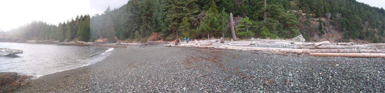
July 22, 2019 at 2:44 am #17445Mick AllenAnd then looking from Partington Pt S over to Jedediah, you can get an idea of the usability of the site as well as a basic indication of the proximity of Jedediah. [to get a better view of any image, rt click and ‘view image’]
 July 21, 2019 at 11:41 pm #17444Mick Allen
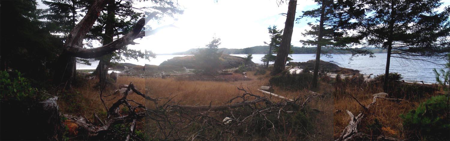
The site identified as Partington Pt South on the bc marine trails map and it’s close neighbour Mt Shepherd [I called Partington Pt North – which sorta makes sense to me as they are so close] are 2 great staging areas in that part of Texada island. The beach on the north site is a little smaller and there is a bit of a grass hill to hike up but there are loads of flat regions there. The South side has a beach to die for and an immediate flat upland that could hold many tents, though not sanctioned by BC parks. But in a pinch if one had to mark time for weather, sure looks great.
The far left beach in the distance is the northern site.
July 21, 2019 at 10:22 pm #17443Heather HarbordI live in Powell River and wrote an out of print sea kayak guide book to the area. On Tues, I’m driving to the Shingle Beach campsite (google it for directions) to car camp Tues and Wed night. I’m driving a blue Subaru Outback Licence 575-KPG and not taking a boat. Many people leave their vehicles at Shingle Beach parked just up from the beach while they cross to Jedediah. You might want to check in with the on-site caretaker. Camping fees are $15/night. I don’t know if there is a cost for parking but I’ll inquire and report back on this forum.
Make sure you have a VHF or weather radio for weather forecasts. Watch out for Qualicum winds which are strong in Sabine Channel. I have found it best to cross either early in the morning or in the evening when, most of the time, the winds are down. There’s nowhere to land at Partington Point (4 nautical miles south of Shingle Beach) and the Cook Bay cottagers have a reputation for being hostile. Further south there is a good camp spot on a little peninsula (before Napier Creek.) Bring water or get it at Napier Creek.
The crossing to Jedediah from Partington Point is 1.1 nautical miles. In the evening watch for cruise ships which come up on you very quickly and leave a huge wash.
Boom Bay dries to sticky mud so I wouldn’t camp there. We arrived at high tide which was fine but had to leave on low tide which was not. Instead, continue round the western coast of Jedediah, pass the entrance to Long Bay and camp in one of the next two small inlets. I can’t remember which is the best one but it has a steeply sloping rocky beach at low tide so no mud and minimal hauling of gear. Lots of grassy tent space. Trails will lead you over to Long Bay (5 mins)and Home Bay (20 mins approx.) where the rest of the mob are camping and anchoring.
July 21, 2019 at 8:46 pm #17442Mick AllenSabine channel does get some wind and currents to 2 knots – so if you’re concerned, time your crossing and check the weather.
Otherwise it’s just 1 1/2 kilometers directly across and there are places to be in some shelter as you make up your mind in doing that crossing. Partington Point north and especially South on Texada Is are great places to mark some time if you have to while deciding what the heck to do. -
AuthorReplies
- You must be logged in to reply to this topic.